VIEWING SITE
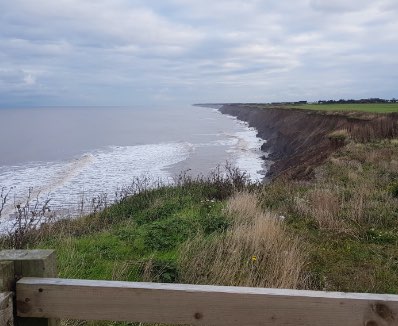
Spurn Washover
#spurndunlin
Explore the location
What’s special about this location?
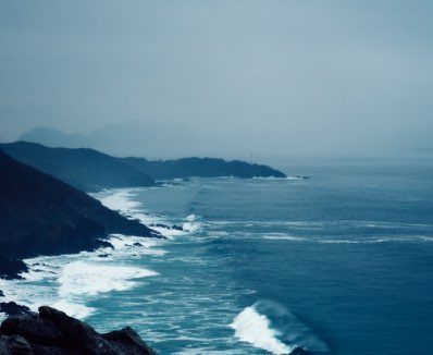
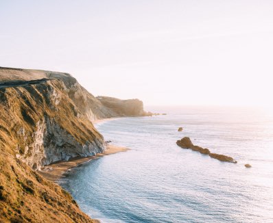
Spurn Point is a constantly moving peninsula – a narrow spit of land which forms a tidal island. It curves out from the mainland for three miles between the North Sea and the Humber Estuary. The landscape is unique and ever-changing, at the mercy of tides and storms.
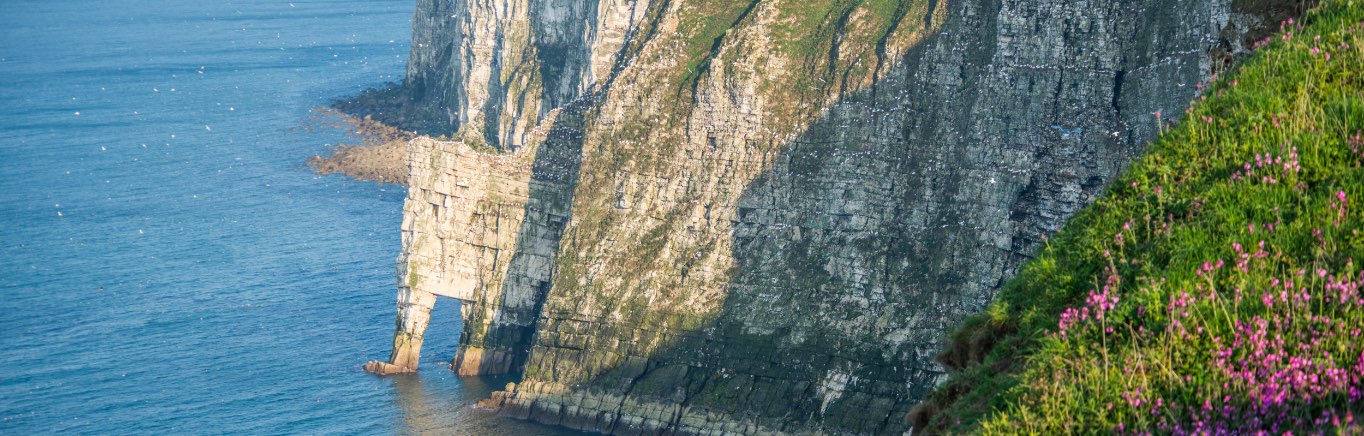
Experience Flamborough
North Beach in 360 Video
Your logo here! We’re inviting schools from across Hull and East Yorkshire to get involved and provide a #Hashtag name for a specific ActiveLearning location. We will include information about each naming school on the website page for that location, referencing them as ‘guardians’.
Explore, discover and capture moments to help our planet
CoastSnap works by enlisting members of the public to take part in our global citizen science project, to capture through your smartphone images of how our dynamic world is changing over time.
By using something called Photogrammetry, scientists can use your photos to make maps at an accuracy similar to that of professional survey team. This is why each location has a camera cradle for you to use and precisely orient your phone and photo. All the information can be recorded via the App or uploading to social media channels. The more photos we have of a particular location, the better our understanding becomes of how environments, such as coastlines, are changing over time, and thus helping communities, local government and stakeholders to better manage these valuable environments.
Add your snap
1. Visit one of our CoastSnap locations.
2. Open the app and create an account with your email address.
3. Select the CoastSnap station for your location.
4. Add your photo using the plus button to ‘update spot’ and follow the on-screen instructions.
5. Place your phone within the cradle so that the camera is facing away from you and is in the correct landscape position.
6. Complete the ‘update spot’ form in the app and save your snap to submit it. You can also upload a recent photo from your gallery.
7. If you don’t have the CoastSnap app, you can still share the photo via social media channels (Facebook, Instagram, Twitter handles)
8. Take the snap and share it via on our social media channels using the location hashtag #spurndunlin
What happens to my snap?
We will use your CoastSnap images to map the way the environment changes over time. Your image is an accurate record of the locality at that moment. Your image will become part of a community database and will enable us to monitor how different environments are changing through time, creating time-lapse movies of the location.
What’s in the area?
Kelsey Gardens
Kelsey Gardens is a parkland of woodland and two lake, located close to the village of Burstwick in the Holderness area, where you can enjoy a range of activities including fishing, canoeing and kayaking.
The Lighthouse Trail
Beginning at Spurn, a sandy spit of land at the mouth of the River Humber, and travelling north through Withernsea to the chalk cliffs of Flamborough, the entire Lighthouse trail is about 45 miles and a discovery of the history of the region’s lighthouses.
Spurn Unimog rides
Spurn Safaris take place aboard a giant ex-military Unimog vehicle which acts as a giant mobile wildlife hide, with tours shceduled regularly you can learn all that this unique stretch of land has to offer.